
The traditional crossing point of the River Cart in the area was the bridge known as the Snuff Mill bridge, on the traditional main road from Glasgow to Ayr. Although there is a 1627 date-stone built into the bridge’s downstream face, and records confirm work was done to the bridge in the 1620s, there was already a bridge on the site back in the 1580s.
River Crossings
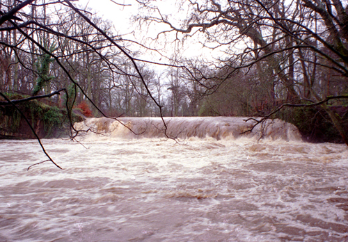 There was also a ford on the downstream side of the bridge, although there has always been argument about exactly where it was, due to the steepness of the bank on the Holmhead side. In 1722 Francis Murdoch drowned at this ford on his way from Glasgow to Ayr, when the river was in spate. Most bridges had a ford adjacent, to avoid the toll, though in winter floods it was foolish not to use the bridge. The bridge made the spot a focal point of the area, as the nearest bridge downstream was at Pollokshaws and upstream (later) at Dripps. From the Snuff Mill Bridge, the road climbed steeply up to Braehead, then along Netherlee Road, and through Bogton to Netherlee. The bridge further down at Holmlea was first proposed in 1799 where there was another ford called the Stepping Stones, and Clarkston Road was a modern route built on a new alignment.
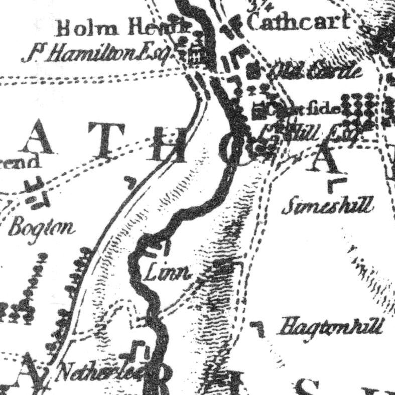 Apart from the main Glasgow to Ayr road, there were two local roads through Linn. The first came off the Carmunnock Road at Croftfoot (on the line of present Croftfoot Road). It passed what is now Linn Golf Course club house near Hagtonhill, then round the present driveway to Linn. It continued down by the stables courtyard to the river. The road then forded the Cart upstream of where the Ha’penny bridge would later be built, to Burnside Road at Netherlee. Burnside Road ran along the traditional boundary between Netherlee and Bogton. At the fording point a pipe bridge used to carried a water main across to the park. This was a challenge for local children to cross. The structure deteriorated and was removed in the late 1960’s and a large concrete block on the riverside is all that remains. This ford was forcibly closed in the 1790’s to prevent avoidance of tolls on the main route.
The second local route was the back road from Cathcart village to Carmunnock. Leaving Cathcart village by Old Castle Road, it continued up the track from Linn Park Golf Course clubhouse to Hagtonhill Farm, then along the edge of the Top Wood in the park, where it can still be traced as a track flanked by ditches and banks. It then dropped down to the back of what is now St Raymond’s Primary School on Lainshaw Drive, then climbed very steeply up the opposite side in a deep hollow way to Mid Netherton and on to Carmunnock. Improvements to the area, especially mineral exploitation, added further routes. Linn estate developed its own private paths, though many have fallen into disuse in the past 30 years.
Linn Bridge

The uniting of the lands of Bogton and Linn joined the lands on both sides of the river in 1792. However Linn would not become a true estate until a bridge was built across the river. This was recognised by the owners, and from 1801 successive adverts for Linn included the potential of building a bridge at Linn, if Gordon of Aikenhead could find a ‘good tenant’.
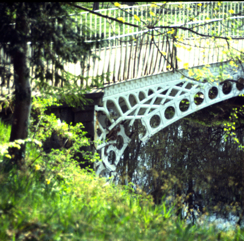
The bridge above Linn falls has a variety of names, including the Iron Bridge, the Ha’penny Bridge and more recently the White Bridge. The name Ha’penny bridge has lasted longest, and was based on the circular holes in the cast iron arches, which resembled coins. A twisted interpretation has claimed that the name stemmed from a halfpenny toll charged for crossing the bridge, but the bridge was never a toll bridge. The 1835 date usually given for the building of the Ha’penny Bridge comes from an advert of that year, describing it as a ‘handsome iron bridge’, but the bridge was not described as new, and is probably a few years older. Reflecting the source of money for the bridge and estate, the Ha’penny Bridge reputedly has an African face cast into each of its four iron arches. It is ironic that in recent years the bridge has been dubbed the ‘White Bridge’.
The bridge is vulnerable to flooding, when the river cuts the corner, partly bypassing the bridge. The upstream cast iron arch was damaged by the impact of a large tree washed down the river in the early 1980’s. This was an unexpected boon to walkers. Since then, vehicles have been prevented from crossing the bridge.
Netherton
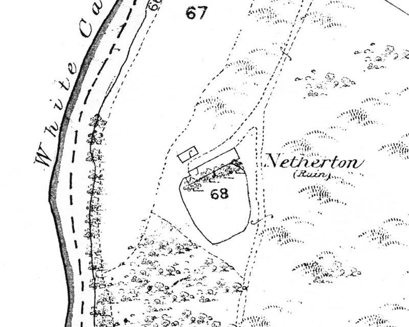
South of Linn, Netherton Braes stretches from Linn Cemetery all the way to the Kittoch Water at Busby. Netherton was the property of the Stuarts of Castlemilk. Although only a short distance across the Cart from suburbia, Netherton is a haven for wildlife, including deer and badgers. The network of old tracks beneath the woods, some related to farming, and some to abundant mineral exploitation, make it a walker’s paradise.
Netherton was originally a fermtoun, the ‘Nethertoun of Carmunnock’ which latterly became Netherton Farm. This farm was located at a ford leading across to Netherburn Avenue at Netherlee and on to Giffnock. During farming improvements in the late 18th century Netherton was split into four separate farms: Netherton (Braes), Laigh Netherton, Mid Netherton and High Netherton. There was another farm, Garsheugh near the junction of the Kittoch Water and the White Cart in the 1750’s, but this disappeared and was merged into Netherton Braes. As at Linn, improvement of the area depended on bridging the river. A bridge was proposed from the 1790s, crossing from Netherton to Netherlee, but was never built, and by the 1860s Netherton Farm was a ruin.
Limestone Quarry

The limestone industry in Cathcart provided steady employment for a handful of men. By the late 18th century the growing demand for lime had raised the local lime industry to the largest employer in the parish.
As the quarries deepened, it became more convenient to mine the limestone. By the 1790s, underground working was in operation at all three Cathcart quarries. The limestone was followed south into what is now Cathcart New Cemetery, behind the old Cemetery Lodge, deep into the cemetery hill.
A drainage tunnel or level was driven from here, following the outcrop under the hill gently eastwards, to Linn waterfall. In addition to draining the quarry, the tunnel gave access to some of the later underground workings.
Cathcart Cemetery
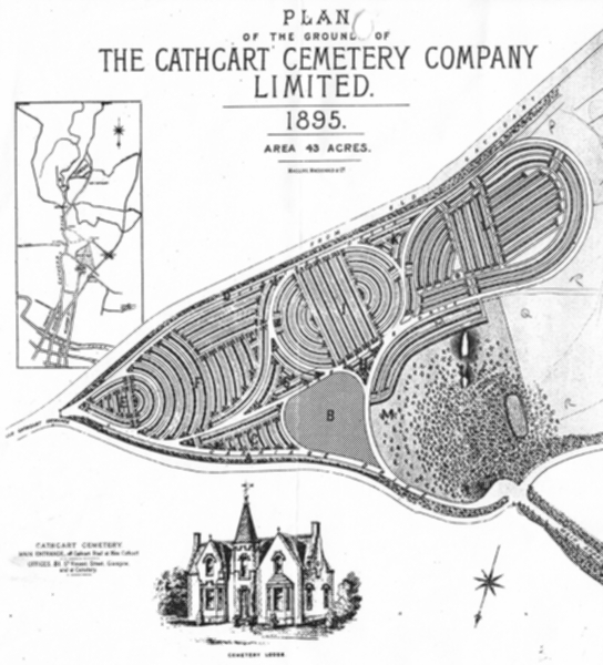 The development of Linn Park was part of Glasgow’s controversial ambition to expand into suburbia. Cathcart cemetery replaced the old kirkyard in Cathcart village, which could no longer cope with the expansion of the parish from the 1870s.
The old part of the cemetery was laid out on Bogton land by the leading Scottish Cemetery designer William McKelvie, disguising the deep lime workings at its heart.
There is a separate article on the history of Cathcart Cemetery provided by the Friends of Cathcart Cemetery.
Previous Section: 19th Century Changes
Last Section: 20th Century Developments